Counts the number of occurrences of each location, then by default maps the
count to the fill aesthetic. If your data has only one row per location and
some other field that you'd like to map to aesthetics, use
geom_sf() or geom_sf_inset()
with stat = "automap" instead.
Usage
geom_choropleth(
  mapping = aes(),
  data = NULL,
  stat = "choropleth",
  position = "identity",
  ...,
  feature_type = NA,
  inset = waiver(),
  map_base = "normal",
  map_inset = "auto",
  na.rm = TRUE,
  show.legend = NA,
  inherit.aes = TRUE
)

stat_choropleth(
  mapping = NULL,
  data = NULL,
  geom = "sf",
  position = "identity",
  ...,
  feature_type = NA,
  na.rm = TRUE,
  show.legend = NA,
  inherit.aes = TRUE
)
Arguments
- mapping, data, stat, geom, position, na.rm, show.legend, inherit.aes, ...
See
ggplot2::geom_sf().- feature_type
Type of map feature. See
feature_types()for a list of registered types. IfNA, the type is guessed based on the values infeature_names.- inset
Inset configuration; see
configure_inset(). Ifwaiver(), the default, this is inherited from the coord (seecoord_sf_inset()).- map_base
Controls the layer with the base map. Possible values are
"normal"to create a layer as though the inset were not specified,"clip"to create a layer with the inset viewport cut out, and"none"to prevent the insertion of a layer for the base map.- map_inset
Controls the layer with the inset map. Possible values are
"auto"to choose the behaviour based on whetherinsetis specified,"normal"to create a layer with the viewport cut out and transformed, and"none"to prevent the insertion of a layer for the viewport map.
Details
Note that choropleths have a tendency to be misleading by emphasising geographically larger areas.
Computed variables
- count
rows matching the region
- geometry
sfgeometry column- ...
limits as computed by
ggplot2::stat_sf()
Aesthetics
stat_choropleth() understands the following aesthetics. Required aesthetics are displayed in bold and defaults are displayed for optional aesthetics:
| • | location | |
| • | fill | → ggplot2::after_stat(count) |
| • | group | → inferred |
Learn more about setting these aesthetics in vignette("ggplot2-specs").
Examples
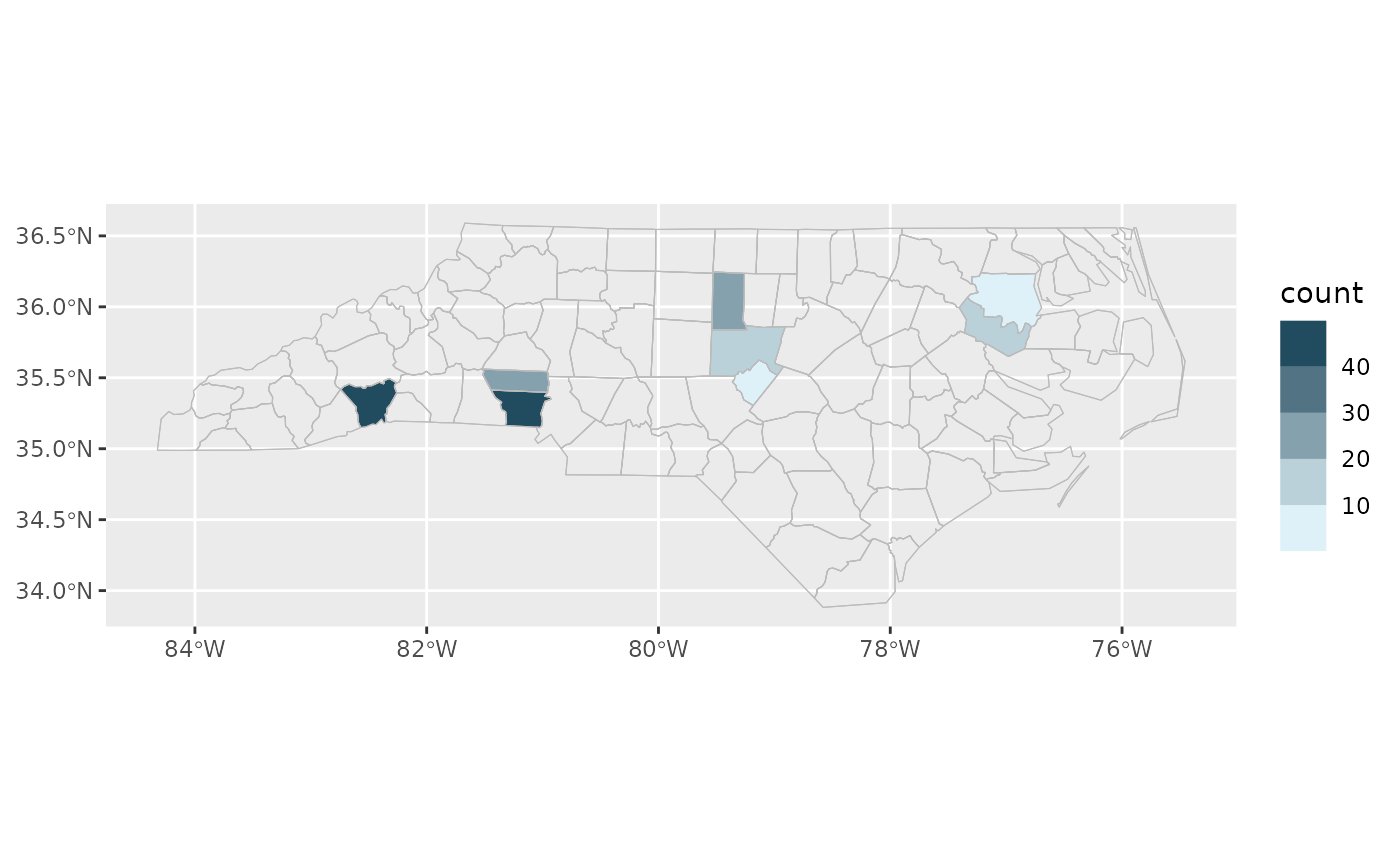
library(ggplot2)

cartographer::nc_type_example_2 |>
  ggplot(aes(location = county)) +
  geom_choropleth() +
  geom_boundaries(feature_type = "sf.nc") +
  scale_fill_steps(low = "#e6f9ff", high = "#00394d") +
  coord_automap(feature_type = "sf.nc")